.. Photo Quiz ..
..
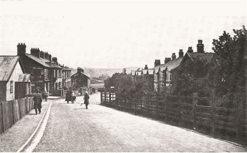
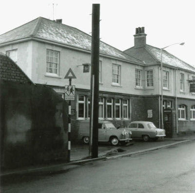
![]() Hmm, what street is
this ?.
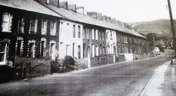
Hmm, what street is
this ?.
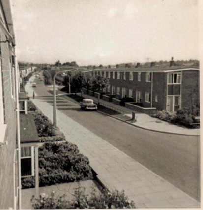
... If you know click here to email me ...
Do you have a memory you would like to share? click here
copyright�cwmbran.info![]()
..
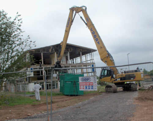
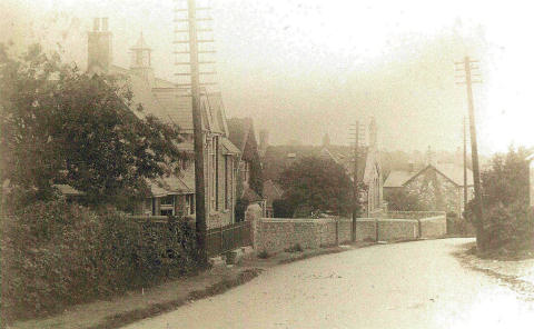
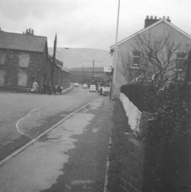
![]() Hmm, what's
happening here ?.
Hmm, what's
happening here ?.
.. July 2012 ..
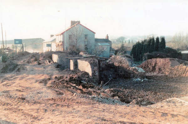
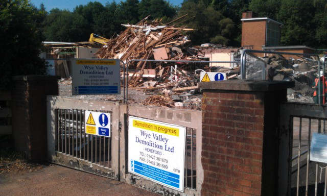
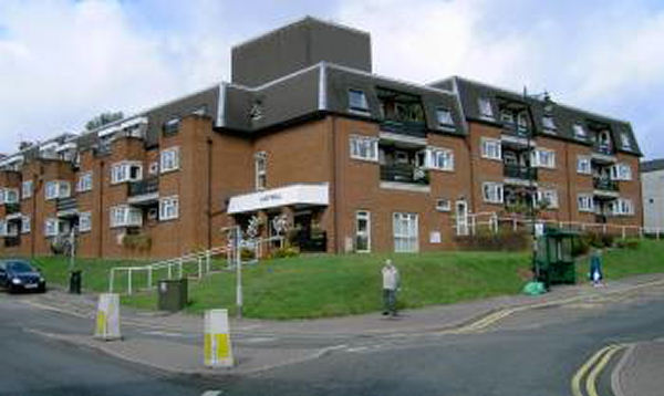
..The latest photograph is obviously the demolition of the old Coed Eva Secondary School/Hollybush Junior school.
Mel Hillman relates:
I was one of the cohort moved from Croesyceiliog Sec School in September 1960 when the school opened. We were joined in in Year 8 (then 2nd year) by another cohort from Llantarnam Secondary School to form just three years - (1st to 3rd). The numbers grew over the years to the start of a small 5th form in 1963/64. Surrounded by open fields in those days - only access was via Ton Road. I left in July 1964 after 'O' Levels to start work. There were some outstanding teachers in those years - 'Wilf' Williams (Maths & Deputy Head), Ewart Pryer (Science), John Nash (Woodwork), Gwyn George (Metalwork), Mrs Haines (English) and Miss Phillips (Art) amongst others.....sadly the Headteacher, Mr Little, died whilst we were on a school trip to Paris in 1963 and 'Wilf' took over as Acting Head. I really enjoyed my four years there|
.. And the winner is ..
Mel Hillman ..from Yeovil, Somerset .. |
copyright�cwmbran.info![]()
..
![]() Hmm, I
wonder who remembers this row of shops ?..
Hmm, I
wonder who remembers this row of shops ?..
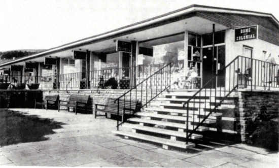
This photograph circa 1960`s shows the row of shops, West Pontnewydd (adjacent Maendy Way) For a little more info click here ..
copyright�cwmbran.info![]()
..
![]() Hmm, I
wonder what's happening here ? (recently)..
Hmm, I
wonder what's happening here ? (recently)..
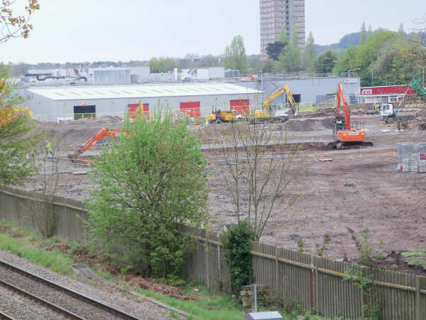
Photographed May 2012 shows the first phase of the new Morrisons supermarket on Grange road. (Merritor ex-Girlings in the background).
copyright�cwmbran.info![]()
..
![]() Hmm, I
wonder where this was photographed many years ago ? ...
Hmm, I
wonder where this was photographed many years ago ? ...
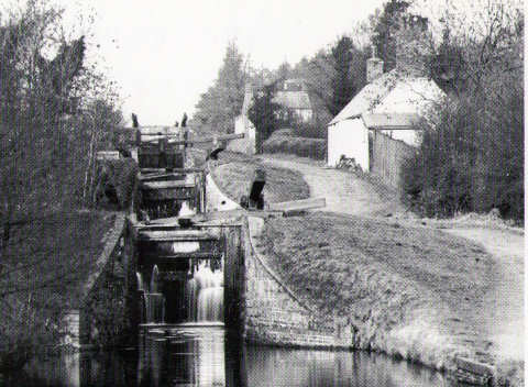
This photograph (date unknown), shows the `locks` at 5 Locks, Pontnewydd;
The white cottage in the foreground, belonged to Charlie Beniam, the Lock Keeper in the 1940`s,The bridge adjacent to the the `Cross Keys Public House` is in the distance.
..The photograph was taken adjacent to the recreation ground..
Charlie Beniam`s son Tom was also a Lock Keeper at Pontnewydd; he had a cottage on the canal bank further down the canal, adjacent to the lock near Cae-yr-Ebol.
copyright�cwmbran.info![]()
..
![]() Hmm, what's
going on here ? ...
Hmm, what's
going on here ? ...
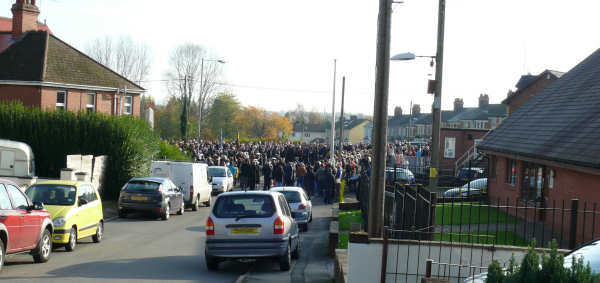
This photograph contributed by Graham Pattimore, and taken from Clark Avenue, Pontnewydd shows the local community, dignitaries, representatives of the Church, uniformed forces and groups, gathered at the Cenotaph on remembrance Sunday, paying their respects to the local soldiers, who fought and lost their lives in the first and second World wars and more recently, Iraq/Afghanistan conflicts.
.. for more photographs and information click here ..
..
![]() Hmm, what's
going on here and what are the buildings on the right? ...
Hmm, what's
going on here and what are the buildings on the right? ...
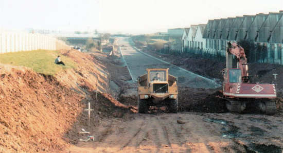
Hmm, I may be way off the mark, but is this the construction of Cwmbran Drive along the old railway line? - it was built after I moved away from Cwmbran so don't know the full details. The building on the right looks like the old Alfa Laval factory - producing milking machines... Webmaster: `Spot on` Mel.
copyright�cwmbran.info![]()
..
![]() Hmm, Do
you have any memories of this building? ...
Hmm, Do
you have any memories of this building? ...
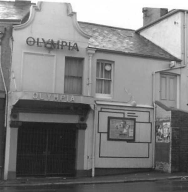
Garnet `Chippy` Chapman relates: Obviously this is the cinema in Old Cwmbran. Two memories of this place are;
Firstly, we used to climb the fence opposite the Abby Hotel, run across the railway line up over the fence which led to the gents toilet for the cinema and then we would walk in and sit down and see the film free.
Secondly the Usherettes went home at nine p.m. so only the projectionist was on duty and one particular evening he had to get the police in as we were running outside gathering snow and there was one almighty snowball fight inside the cinema [ha ha ] I wonder what would happen if you did that today?
.. for a few more memories click here ..
copyright�cwmbran.info![]()
..
![]() Hmm, can
you name this building? ...
Hmm, can
you name this building? ...
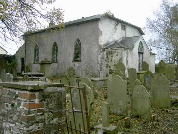
...This building was originally Zoar Baptist Church (1836 - Grade II listed), but is now a private residence ...
copyright�cwmbran.info![]()
..
![]() Hmm, can
you name this location and approximate date? ...
Hmm, can
you name this location and approximate date? ...
( Photograph kindly contributed by John Jenkins)
copyright�cwmbran.info![]()
..
![]() Hmm, can
you name this building and it's location? ...
Hmm, can
you name this building and it's location? ...
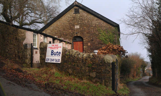
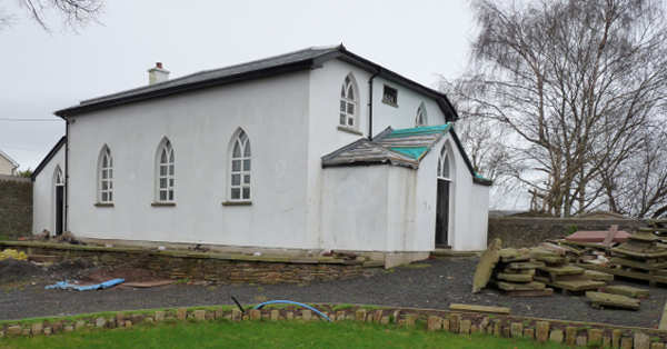
.. There is planning permission for residential use .. another one bites the dust .. economical and/or cultural .. a sign of the times ??
copyright�cwmbran.info![]()
..
![]() Hmm, can
you name this building? ...
Hmm, can
you name this building? ...
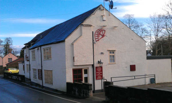
This photograph taken December 2011 shows the Mill Tavern` (recently closed), situated on Coed Eva Mill road, just off Ton Road, Coed Eva. another one bites the dust .. economical and/or cultural .. a sign of the times ??
copyright�cwmbran.info![]()
..
![]() Hmm, I
wonder where I would of seen this scene and what was `going on`? ...
Hmm, I
wonder where I would of seen this scene and what was `going on`? ...
This photograph shows the "old railway bridge" being demolished on Llandowlais Street where Cwmbran Drive is now, the old wireworks buildings can be seen to the left. (contributor: John Jenkins)
Lyn Thomas relates: The `old` railway bridge on Llandowlais street was demolished and filled in late 1960`s early 1970`s . It was made into a two lane road. When Cwmbran Drive was built it was dug back out and a bridge reinstated. It was filled in because the railway line was closed.
Anne Williams (West Mids.) This is a view from Oakfield looking towards Llandowlais Street, with the `wireworks` in the distance , behind the shops on the right . I�m guessing it was back in the 1960`s when they renewed the bridge over the old railway. To the right of the demolition work is where Cwmbran stadium stands today. Cwmbran Drive now runs where the `old` railway line used to be.
Karen Selway relates: This photograph is
looking up Llandowlais street when Cwmbran Drive was
being constructed along the old railway line. On the
right is Osborne's shop and the next buildings along
are what used to be the `Hong` fish and chip shop,
now `Jade Garden`, the `betting office` and a `taxi
company`?
copyright�cwmbran.info
I used to have great fun sliding down the embankment
on large pieces of cardboard ... usually into a pile
of nettles (no steering) ; There were always juicy
blackberries as compensation though and a dock leaf
to dull the pain.![]()
..
![]() Hmm ? ..
Hmm ? ..
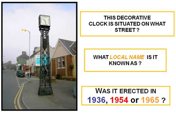
... And the answers are: Victoria Street, War Memorial Clock and 1936 ...
..
![]() Hmm, What
is the name of this `watering hole` ? ..
Hmm, What
is the name of this `watering hole` ? ..
... This is the Bush Inn - Graig Road, Upper Cwmbran ..
copyright�cwmbran.info![]()
..
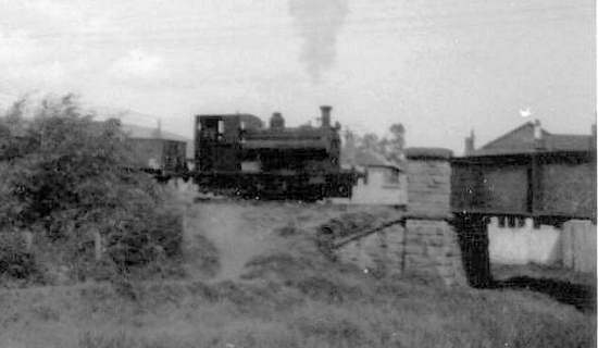
![]() Hmm, What
connection has this steam engine with Cwmbran ? ..
Hmm, What
connection has this steam engine with Cwmbran ? ..
This is the steam engine `WHITEHEAD` that once operated to and from the `Whitehead` brick works off Llandowlais Street, Ty Coch ..
For more interesting information and where is `Whitehead` now? ... Click here ..
copyright�cwmbran.info![]()
..
![]() Hmm, I wonder where
I would of seen this scene, many years ago? .. and what
is different today ? ..
Hmm, I wonder where
I would of seen this scene, many years ago? .. and what
is different today ? ..
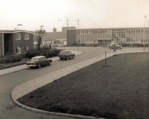
..Photograph kindly contributed by Mel Hillman - circa 1960..
Karen Selway relates: This photo is looking
from Northville towards the old health clinic (now demolished). The main
road can no longer be accessed by traffic and there's a subway that takes
you under the busy one way road that brings you out by Blockbuster. Behind
the clinic is the Asda employee car park and the road that takes you to
the rear of the post office. I remember going to the school dentist at that
clinic, the dentist told me he had magic air (ha ...anaesthetic). The four
year old me wanted some of that ...woke up minus a tooth and
was compensated with a trip to Woolworths for a ride on Bugs Bunny at
sixpence a go.
I love the photograph of Llandowlais Place/Street, although that particular
image is before my time I remember vividly the houses, wire works, trains
crossing, the Railway Inn and Waters' (Billy I think) shop which was further
up on the right by the canal. Was sent there many a time on a Sunday to get
oxo's to make gravy for Sunday lunch and then going to Sunday School
afterwards at the Gospel Hall which is still on Oakfield road. In fact I
still see my old Sunday school teacher on occasions.
When I was younger there was a gift shop instead of one of the houses (as
mentioned by one of your contributors) I loved going in there although I
could never afford to buy anything. The lady who owned/worked there was
lovely though and always let me browse.
I can remember playing a silly game of tag on that narrow pavement outside
those houses and narrowly being missed by a double decker bus that swerved
to avoid me and hit a telegraph/phone pole on the opposite side of the road.
I was taken into one of those houses and given milk ..a drink I've always
hated and still do. I had to have a stitch in my knee and a sobering visit
from a pc a few weeks later about the lessons of being sensible on the road
...lessons I've never forgotten. The poor bus driver was probably more
shocked but being five ..ish I got the attention.
Paul Mahagan relates: That will be the Health clinic at the top end of the now Town Centre, I can remember many trips to there, having the jab, my sugar cube inoculations and the dreaded dentist!!
Isn't the latest pic as you look down Porthmawr Rd towards town? Its
definitely Northville anyway, now has a metal railing across front and ASDA
rather than what looks like old clinic in your pic?
Lindsay Smith relates: My mums folks and my
great grandparents/great aunt and uncle lived in Northville when I was
little - Porthmawr Rd, Orchard Lane and Plas Islwyn - and my stepdad lived
on Caradoc Rd when he was young (late 50's now) - the house on the end
facing town with the Caradoc Rd sign on it - he said he remembers the town
being built - he used to play on the building site - also went into one of
first shops in town and stuffed model airplanes down his wellies...oops! My
Dad was manager at Wildings for years and years so I remember it well - I
used to go into his shop and get kitted out in Ladybird clothes, also used
to pick all the pins out of the carpet because they had those horrible
fluffy carpet tiles at one stage!
..
![]() Hmm, I wonder where
I would of seen this scene, many years ago? .. and what
is different today ? ..
Hmm, I wonder where
I would of seen this scene, many years ago? .. and what
is different today ? ..
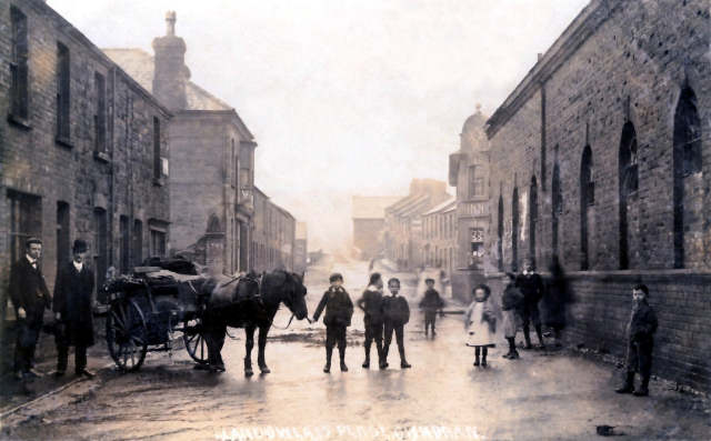
Anne Williams relates: This photograph shows Llandowlais Street, looking up towards Ebenezer Baptist church (far right) .The horse and cart looks like it�s reversing into what would later become my Nan�s front door ! The end house, later became Peterson�s shop which sold household and fancy goods in the 1960`s.
Rob Carter (Kununurra W. Australia) responds: This is Two locks road near the Wire Works. You can see the chapel in the distance. Just to the left was the entrance to the road that led to where 1st Llantarnam scout hall used to be.
Jeremy Purcel (Lamasas,Texas U.S.A.) responds:This photograph is looking along Llandowlais Street towards Two Locks Road. On the right can be seen the old wireworks as well as the Railway Inn, and in the background (just over the humpbacked bridge) is the Ebeneezer Baptist Chapel. What is different today? Everything! None of the buildings shown (apart from the chapel) remain standing as all were demolished in the mid-1970`s.
Kenneth Beake responds: Ah, a very old Llandowlais St; it's where it joins old Hill street, the rail tracks crossed the road here on their way to the brick yard, I think the building with arched windows was a engine shed, I can just see the `Railway Hotel` sticking out above the young girl.
Ralph & Margaret Williams responds: This is Llandowlais Street. The wire works is on the right of the picture, next is the Railway Inn. In the back ground is Two Locks Chapel and the bridge over the canal.
..
![]() Hmm, I wonder where
I would of seen this scene, a number of years ago? .. and what
is different today ? ..
Hmm, I wonder where
I would of seen this scene, a number of years ago? .. and what
is different today ? ..
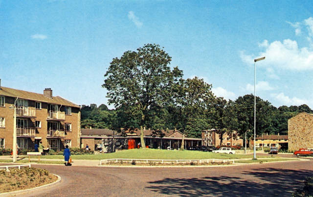
Graham remarks: This is of photograph of Llanyravon Square taken in the 1960s.The phone box is now a new type and the Post Office is not shown in the photo, also the Crows Nest public house hasn't been built.
![]()
..
![]() Hmm, I wonder where
I would of seen this scene, a number of years ago? ..
Hmm, I wonder where
I would of seen this scene, a number of years ago? ..
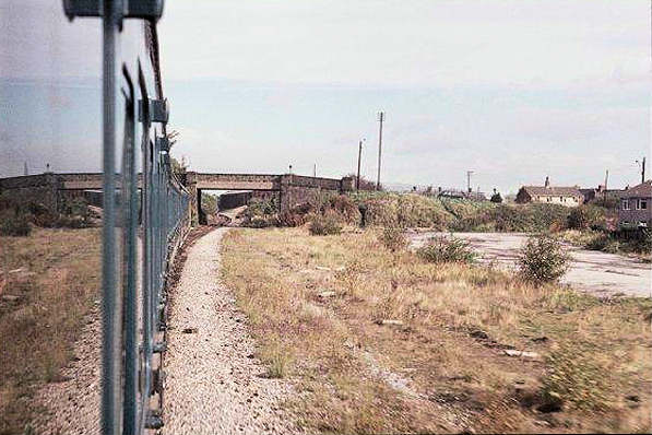
This photograph shows a train train pulling in or leaving Upper Pontnewydd. There was a station here once. The train in the picture must have been one of the very last trains to travel the Eastern Valley line. Over to the right was once the `Goods` yard with Pontnewydd railway bridge and Station road in the background. The train is probably an `enthusiasts special` of some kind as regular passenger trains were withdrawn from the line in 1962.
![]()
..
![]() Hmm, I wonder where I
recently saw this scene ? ..
Hmm, I wonder where I
recently saw this scene ? ..
This photograph shows the demolition of Brookfield Primary school, Southville on the 4th July 2011; the pupils will transfer to Nant Celyn, situated in Hollybush. The `hi-tech` school will accommodate 420 pupils and opens in September 2011. The Brookfield site will then be developed for housing.
![]()
..
![]() Hmm, I wonder where I
would have seen this scene, many years ago ? ..
Hmm, I wonder where I
would have seen this scene, many years ago ? ..
![]()
..
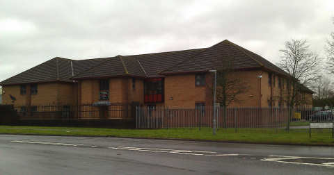
![]() Hmm, I wonder where I
would have seen this scene, many years ago ? ..
Hmm, I wonder where I
would have seen this scene, many years ago ? ..
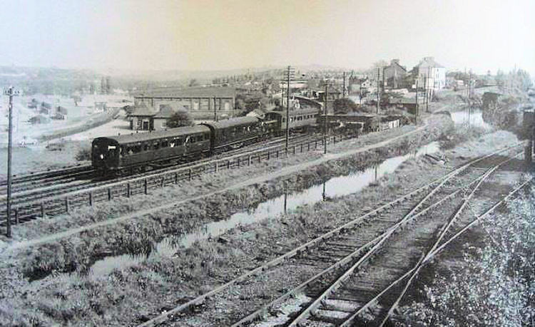
Rob Carter relates: This is the Eastern Valley line, with a train going into old Cwmbran station. My Grand Father was the Station Master.
.. For more detailed info relating to the photograph click
here ..copyright�cwmbran.info
..
![]() Hmm, I wonder where I
would have seen this scene, many years ago ? ..
Hmm, I wonder where I
would have seen this scene, many years ago ? ..
.. This photograph is looking up Newport road, where the Western Biscuit Factory (now Burtons) is, to the junction with Llantarnam road ..
copyright�cwmbran.info
..
![]() Hmm, I wonder where I
would have seen this scene? ..
Hmm, I wonder where I
would have seen this scene? ..
This photograph, circa 1950`s and contributed by Lynn Thomas, shows the `old clay pit` which was on outskirts of Ty Coch
The buildings in the background are the Star brickworks, to the right was the railway line (now Cwmbran drive) to the left is Ty Coch. It was the council tip, & is now Ty Coch ind. estate
.. for more interesting info click
here to view my `brick collection`..copyright�cwmbran.info
..
![]() Hmm, I wonder where I
would have seen this scene? ..
Hmm, I wonder where I
would have seen this scene? ..
This photograph shows the Brick works at Ty Coch, now replaced by `Gifford Close`
for more interesting info click
here to view my `brick collection`copyright�cwmbran.info
..
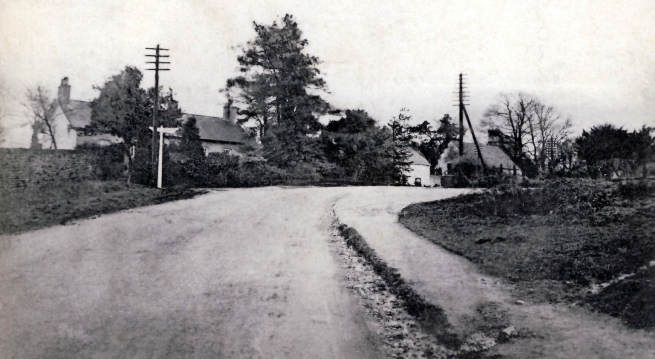
![]() Hmm, I wonder where I
would have seen this scene? ..
Hmm, I wonder where I
would have seen this scene? ..
This Pontnewydd view from the 1940/50`s, was taken from the bridge over `Cwmbran Drive - A4051)`( .. previously the Eastern Valley railway line), looking down Station Road behind the photographer is Commercial Street .. for more info click here.
copyright�cwmbran.info
..
![]() Hmm, I wonder where I
would have seen this scene? ..
Hmm, I wonder where I
would have seen this scene? ..
Photograph contributor: Lynn Thomas
This photograph shows Two Locks Road, built 1883, leading to the `Old Council houses` at the bottom of Cocker Avenue. A small `sweet shop` was, where the second lot of white fronted houses from the left. They have all been pulled down. (Ralph &Margaret Williams)
copyright�cwmbran.info
..
![]() Hmm, I wonder where I
would have seen this scene? ..
Hmm, I wonder where I
would have seen this scene? ..
Anne relates: This is the old primary school on the Highway at Croesyceiliog. I went there in the late 1960's and was in Mrs. Hathaway's class. I still have memories of cold winters huddled around the cast iron stove in the classroom and being sent home when the outside toilets froze over. I think Mrs. Churchill was deputy Head of the school - only the 1st year classes and one 2nd year class were based there, the rest of the pupils went to the main school on North Road. Happy days!
copyright�cwmbran.info
..
![]() Hmm, I wonder can
you name these `watering holes`? ..
Hmm, I wonder can
you name these `watering holes`? ..
From top to bottom, left to right. The Upper Cock Inn (Croesyceiliog) - The Dorallt Inn (Henllys) -The Yew Tree (West Pontnewydd) - Fairces aka `The Terrace`(Pontyhydrun) - The Golden Harvest (now Tesco Greenmeadow) -The Square Inn (Town Center) - The Queens. (Upper Cwmbran)
copyright�cwmbran.info
..
![]() Hmm, I wonder where I
would have seen this scene? ..
Hmm, I wonder where I
would have seen this scene? ..

This photograph kindly
contributed by John Jenkins, shows the North Lodge entrance, (tradesman
entrance), to Llantarnam Abbey, when he took the photo circa 1970 it was
still occupied, but the tenants were under notice to vacate the property.
![]()
..
![]() Hmm, I wonder where I
would have seen this scene? ..
Hmm, I wonder where I
would have seen this scene? ..
This photograph, circa 1960`s, kindly contributed by Roy Jones shows `The Half Way Inn` on
Commercial Street, Old Cwmbran.copyright�cwmbran.info
..
![]() Hmm, I wonder where I
would have seen this scene? ..
Hmm, I wonder where I
would have seen this scene? ..
This photograph kindly contributed by John Jenkins shows Llandowlais Street,taken from the bridge that used to go over the railway (now Cwmbran Drive).... for more info click here
copyright�cwmbran.info
..
![]() Hmm, I wonder where I
saw this scene? ..
Hmm, I wonder where I
saw this scene? ..
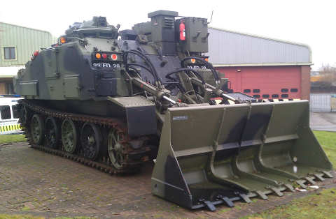
Lawrence Skuse responds: This is a `CET `, or Combat Engineer Tractor and is situated adjacent to the front entrance to the Territorial Army Centre:
100 Field Squadron, Royal Monmouthshire Royal Engineers (Militia) on Ty Coch Way.The `CET` has replaced a W.W. II Churchill `AVLB` (armoured vehicle-launched bridge)
copyright�cwmbran.info![]()
..
.. And the answer could be the snow?
.. but the correct answer I was looking for, was the Pontnewydd annual `Christmas tree` .. and to find out why ? I emailed Torfaen Borough Council on the 15th December 2010 for an explanation and when I get a response I will let everyone know.
Update:31st Jan.2011 I have now received an email response, click here if you wish to email me and receive the response given under `Freedom of Information Act 2000`
copyright�cwmbran.info
..
.. David Evans from Melkbostrand, South Africa kindly contributed this photograph via John Jenkins from Gulang, South Africa ..
copyright�cwmbran.info![]()
.. Hmm, I wonder which road this is ? ..
This photograph contributed by Graham `Ianto` Skuse, now residing in Guernsey-Channel islands; who was about 5 years old at the time, was taken from by 'Somerset Street' looking up the road.
Lawrence Skuse responds:
This is my brother standing outside `Brooklyn`, Grange Road, home of his mother's family, which is next to Prospect, the home of his father's family, about 1950. These two houses stood roughly where the bus station is now located.
copyright�cwmbran.info![]()
.. Hmm, I wonder where I would of seen this ? ..
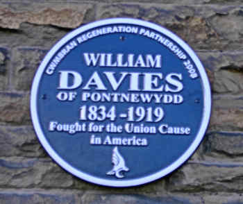
This commemorative plaque is situated on the front wall of Richmond Road Baptist Chapel - Pontnewydd ..
for more related info click here
copyright�cwmbran.info![]()
.. Hmm, I wonder where I would of seen this scene? ..
here ..This photograph shows Hope Methodist Church, Chapel Street - Pontnewydd .. For a little more info click
copyright�cwmbran.info![]()
.. Hmm, I wonder where I would of seen this scene? ..


here ..Newport Road, Llantarnam -1953. The photograph on the left is at the crest of the hill and in the right hand photograph, you can just see the pub sign of `The Greenhouse`. For related info click
copyright�cwmbran.info![]()
.. Hmm, I wonder where I would of seen this scene? ..
This photograph shows Ebenezer Chapel and inset `Boundary stone`, situated at the `The Square`- Upper Cwmbran .. For more info click
herecopyright�cwmbran.info
.. Hmm, I wonder where I would of seen this scene? ..
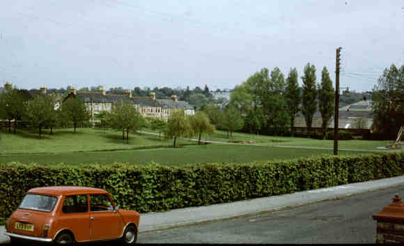
This Photograph is a view of the park adjacent to Brookland Terrace and looking towards Park View - Pontnewydd. circa 1970`s
copyright�cwmbran.info
.. Hmm, I wonder where I would of seen this scene? ..
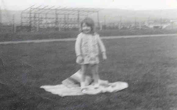
This photograph kindly contributed by Karen Selway (nee Gilmore) shows Karen standing (posing) in front of the `stand` , under construction, of Cwmbran Stadium which opened in 1967 ..
Tom Absalom relates: I also remember the Cwmbran stadium being constructed. I worked for the company that was constructing the roads and terraces, `Petersons` it was called and the foreman was Walter Dash. I was the lad that laid all the paving around the running track and did the terraces in front of the stand. We also did all the fencing which has probably been replaced now as most probably the running track.
copyright�cwmbran.info![]()
.. Hmm, I wonder where I would of seen this scene? ..
This photograph contributed by Sue Smith from Upper Cwmbran, shows the `air shaft` (now demolished) of Mine Slope Adit, for more info in relationship to Porthmawr Colliery (Upper Cwmbran) - click
here ..copyright�cwmbran.info
.. Hmm, I wonder where I would of seen this scene? ..
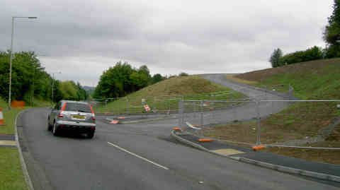
This is a photograph of the entrance to the new cemetery on Hollybush way, currently under construction, it will be known as Llwynceln, which is welsh for Hollybush. The cemetery will provide burial facilities for south Torfaen for the next 50 years.
copyright�cwmbran.info
.. Hmm, I wonder where I would of seen this scene? ..
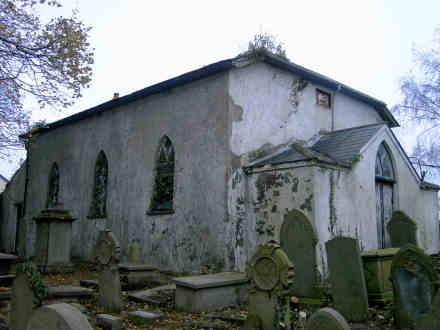
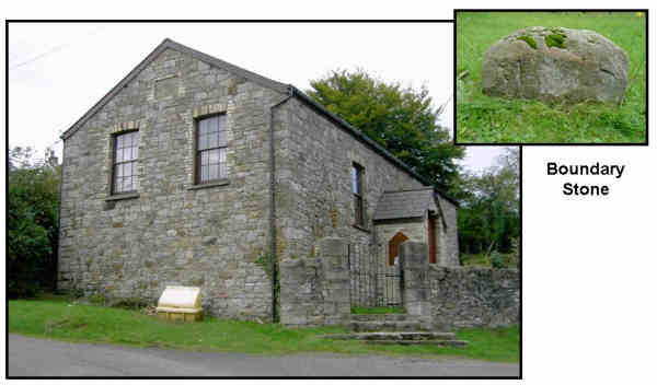
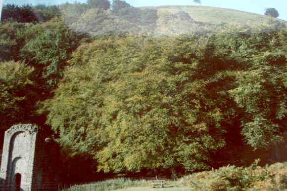
This is a photograph of Zoar Chapel (built 1836) and is situated on Craig-Ceiliog Lane (Henllys-Newport-Risca road) .. for more interesting info click
herecopyright�cwmbran.info
.. Hmm, I wonder where I would of seen this scene? ..
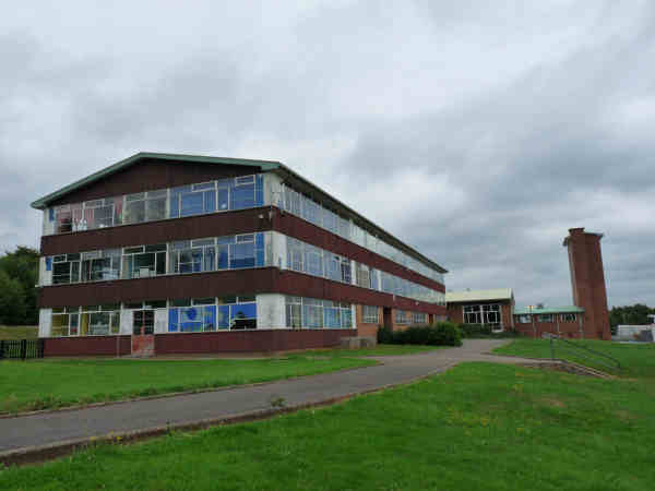
hereThis is a photograph of Hollybush Primary school (Ysgol Gynradd Hollybush), previously Coed Eva Secondary School which closed at the end of the summer term on Wednesday July 14th, 2010.
Do you have a memory you would like to share? click
copyright�cwmbran.info
.. Hmm, I wonder where I would of seen this scene? ..
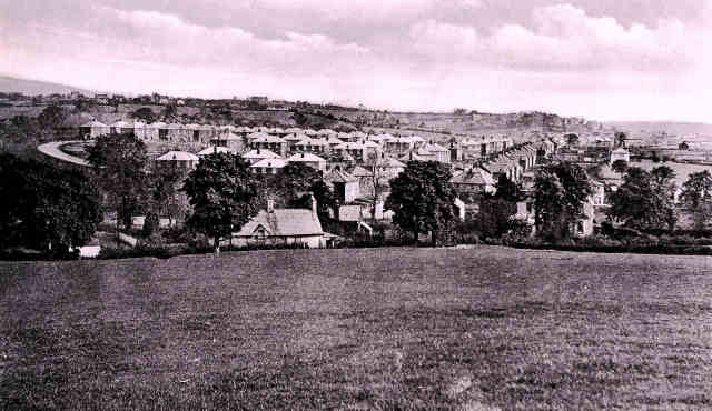
(Photo Postcard 1942)
This photo was taken from the fields where Hollybush estate is now. You can see `The Crescent` to the left before it was finished, also `The Circle` and `Cocker Avenue`
copyright�cwmbran.info